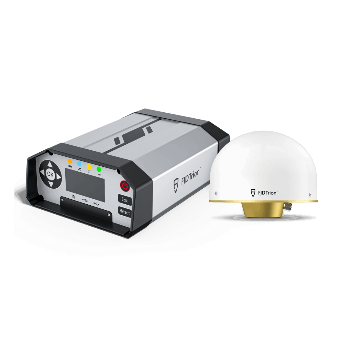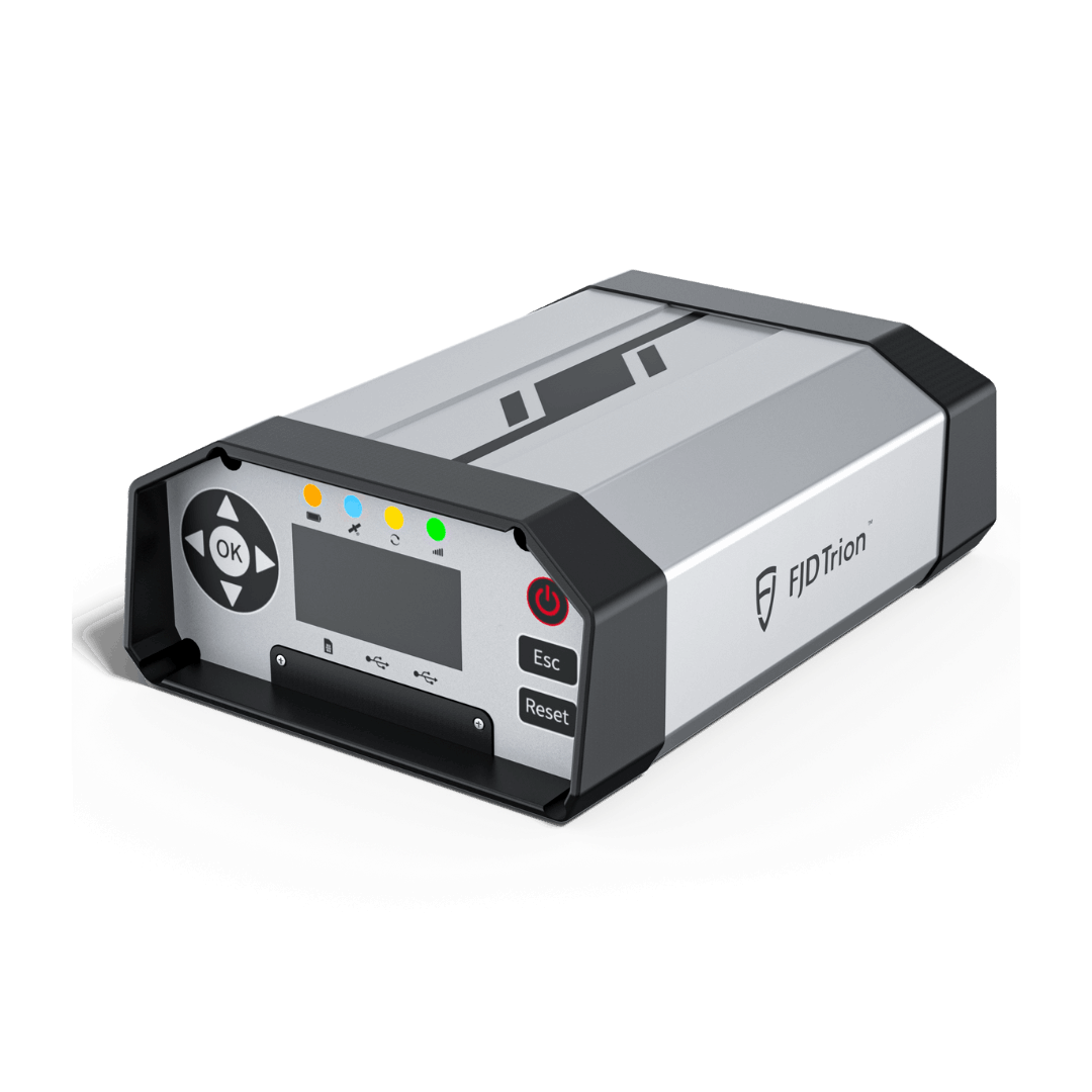


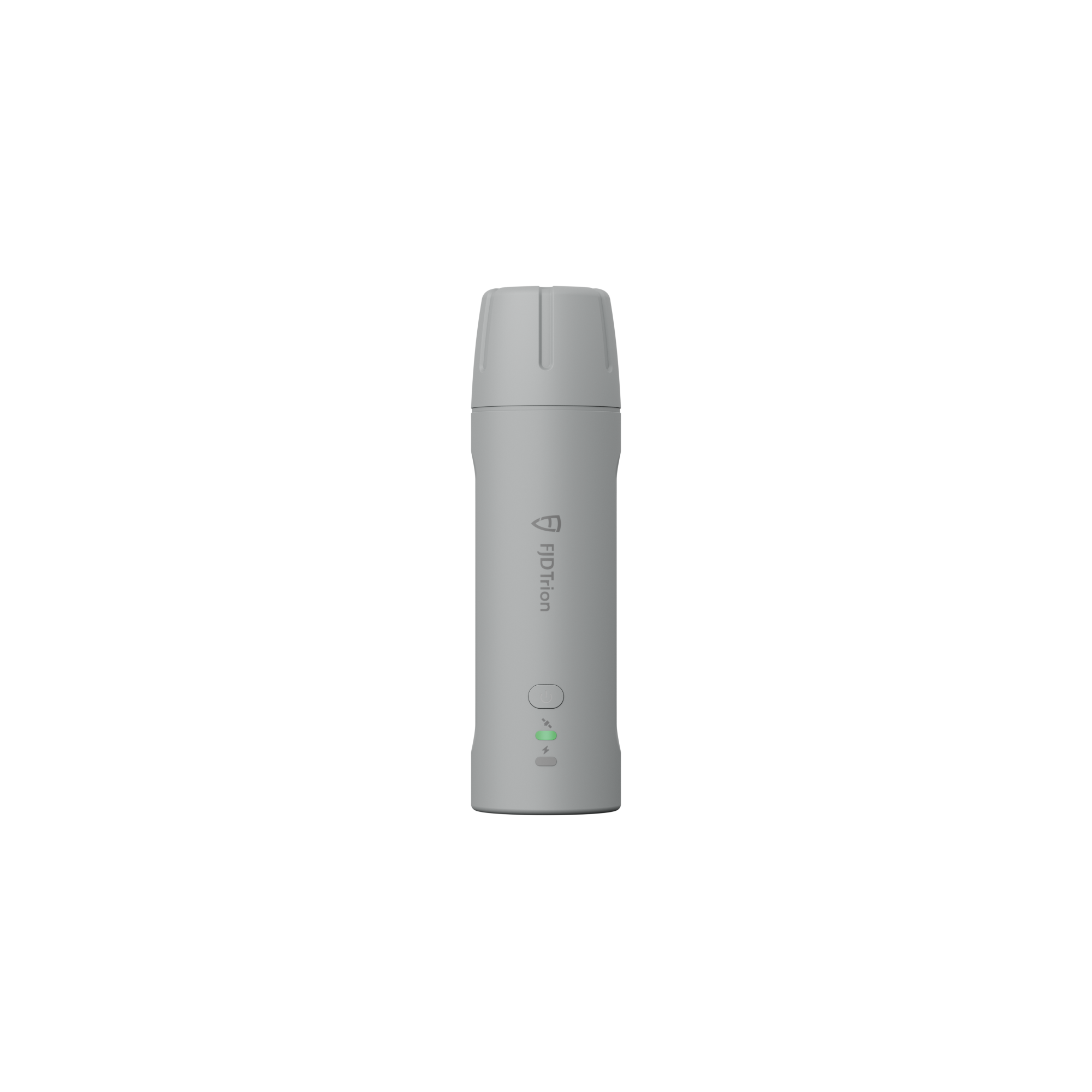
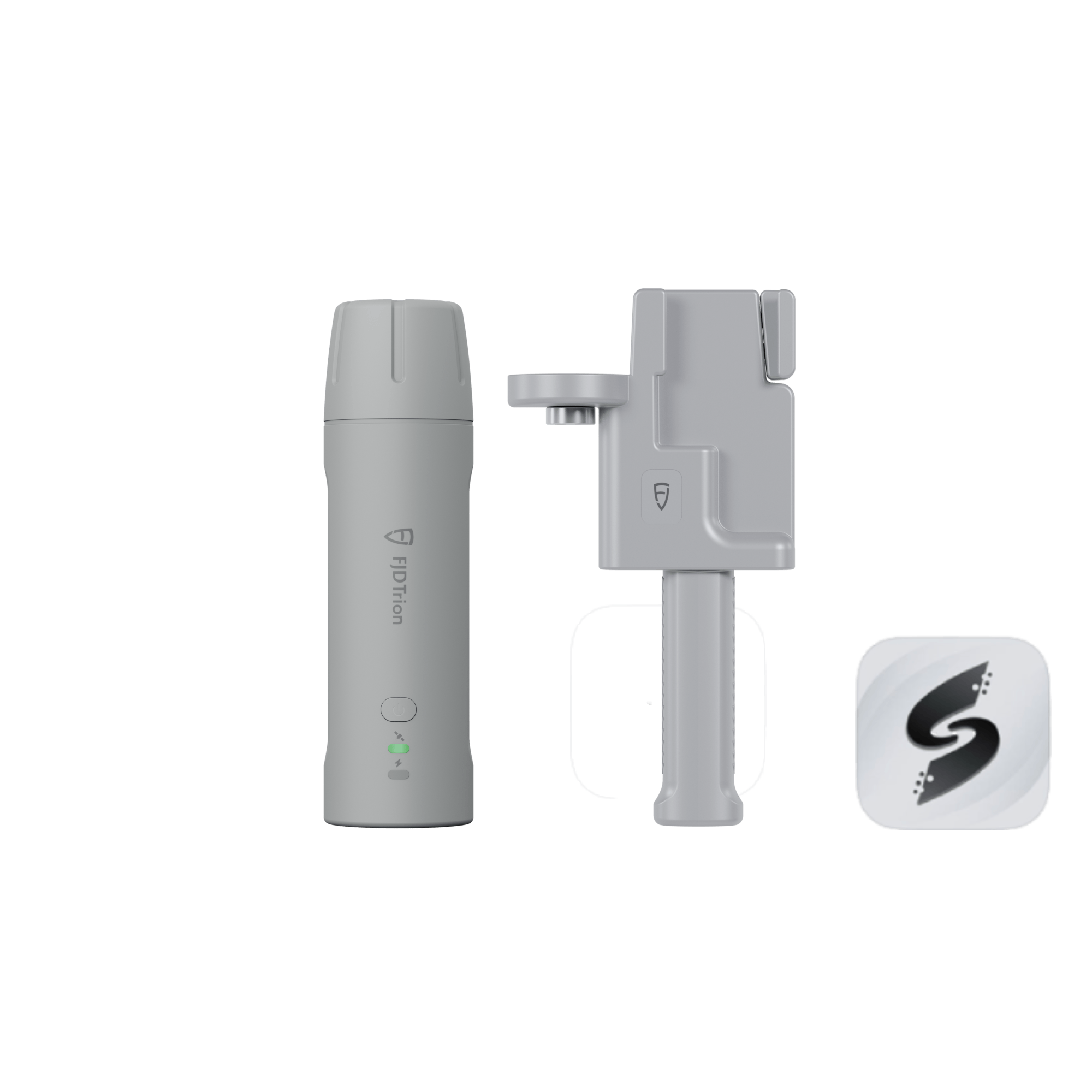
FJD Trion V4E Mini RTK Receiver
Small in Hand, Boundless on Land
![]() Get it between -
Get it between -


Small in Hand, Boundless on Land
The FJD Trion V4E Mini RTK Receiver breaks the boundaries of traditional GNSS receivers with handheld convenience and portable precision. Weighing only 320g, the V4E delivers centimeter-level positioning without centering rods, making it perfect for individuals, teams, and professionals on the go. Easy to use and budget-friendly, it can instantly unlock the power of high-accuracy surveying.

Video
Main Features
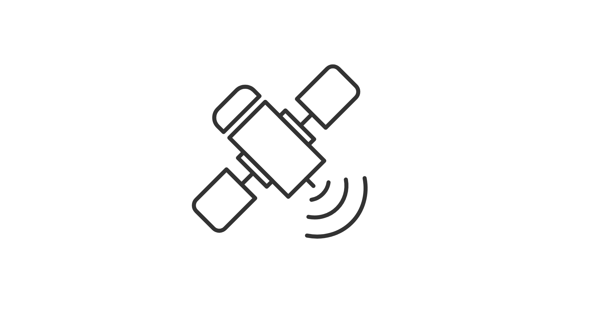
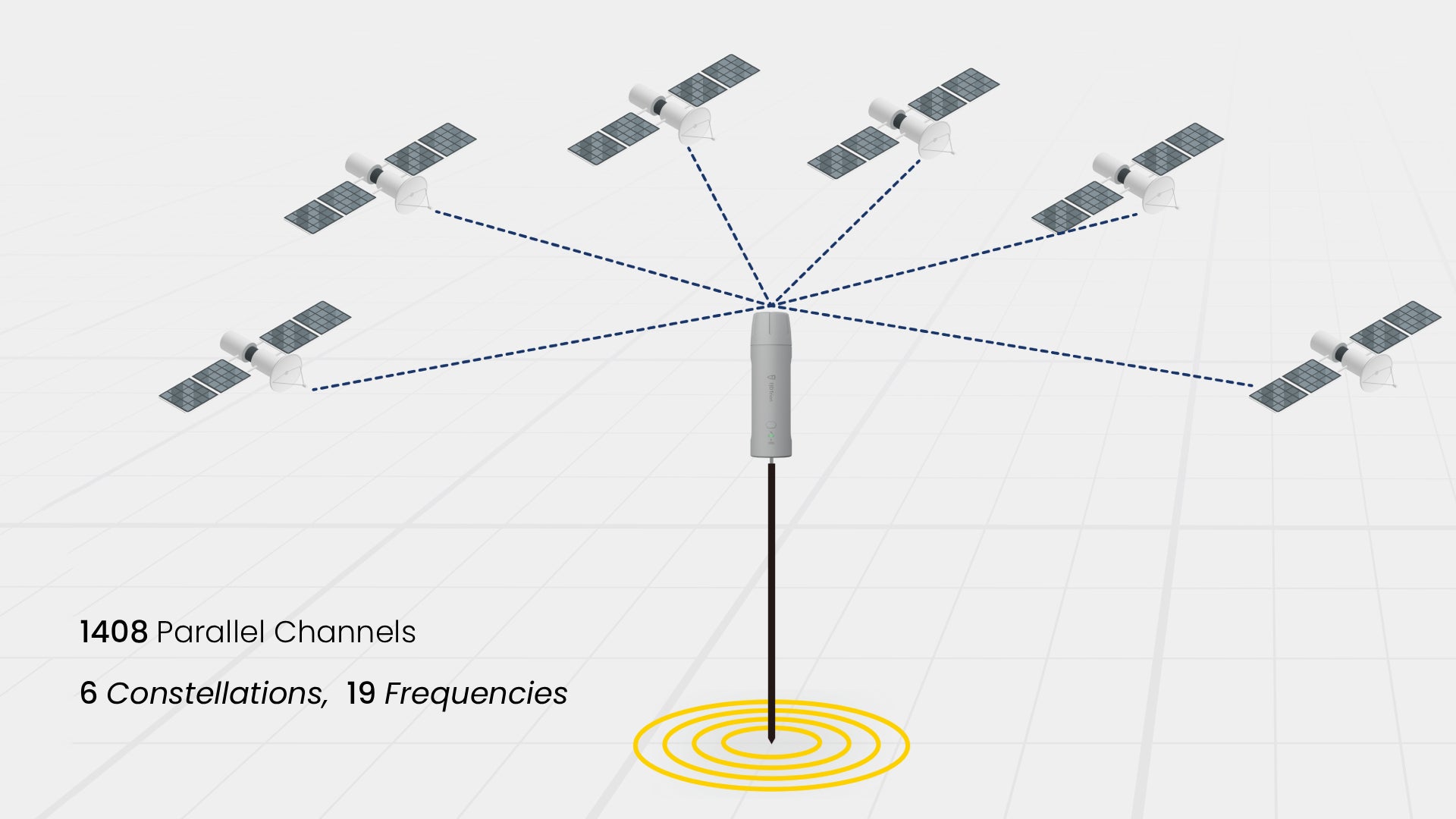
Global Constellations
Supported 1408 Channels

H≤0.8 cm+1 ppm
V≤1.5 cm+1 ppm
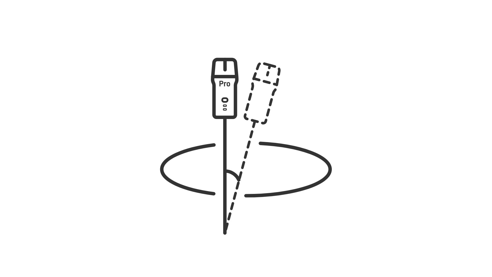
Built-in IMU
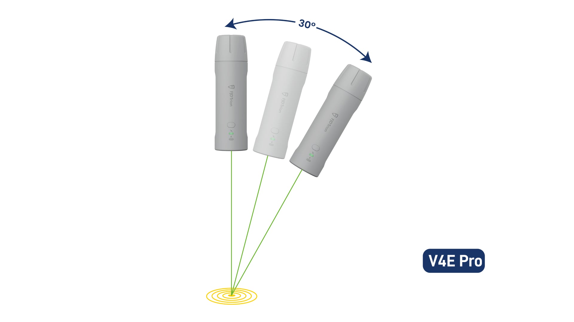
Max 30° Tilt Survey
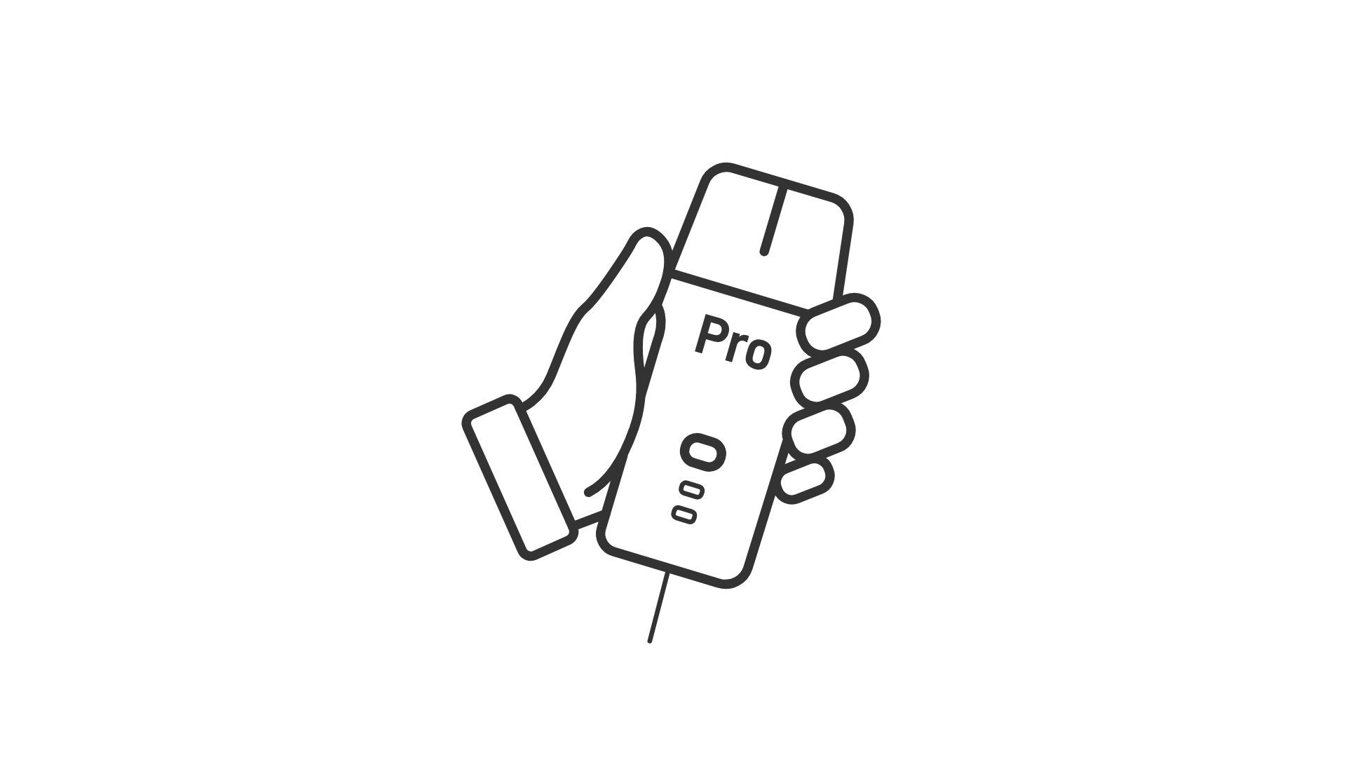
Laser Measurement
Accuracy @3m≤3cm
Startup Time
Cold: ≤30s, Hot: ≤5s, RTK Init:5s
Pocket-Sized
Only 320g
Key Benefits
Small Size, Big Power
Deliver centimeter-level accuracy with ±1.5 cm static precision. It supports 1408 channels and covers all GNSS constellations, including GPS, BDS, GLONASS, Galileo, QZSS, and SBAS. Weighing only 320g, the V4E offers broad compatibility with popular correction services, supporting NTRIP connectivity with RTCM 2.3, RTCM 3.x, and CMR.
No Pole, No Problem
Compensate for tilt angles up to 30° (PRO version) with a built-in IMU, so you don't need to hold it perfectly straight. This gives you ≤3cm accuracy at a 3m distance without a leveling rod. Its onboard LiDAR rangefinder in the PRO version also achieves ±3mm precision at a 10m distance for precise point targeting.
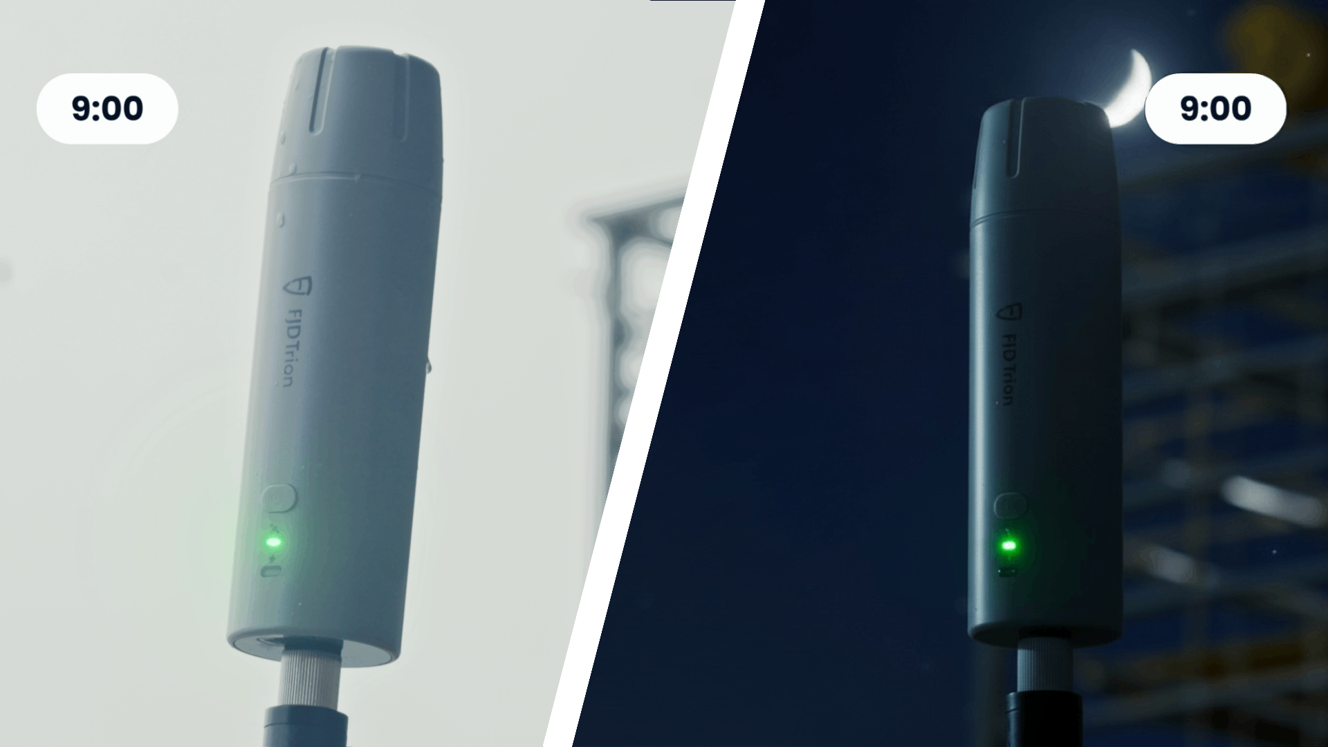
Built Tough for All-Day Efficiency
Stay powered up for the entire workday. It can run for over 12 hours and takes less than 3 hours to charge. You can even keep the V4E working while charging it with a power bank, so your work is never interrupted.
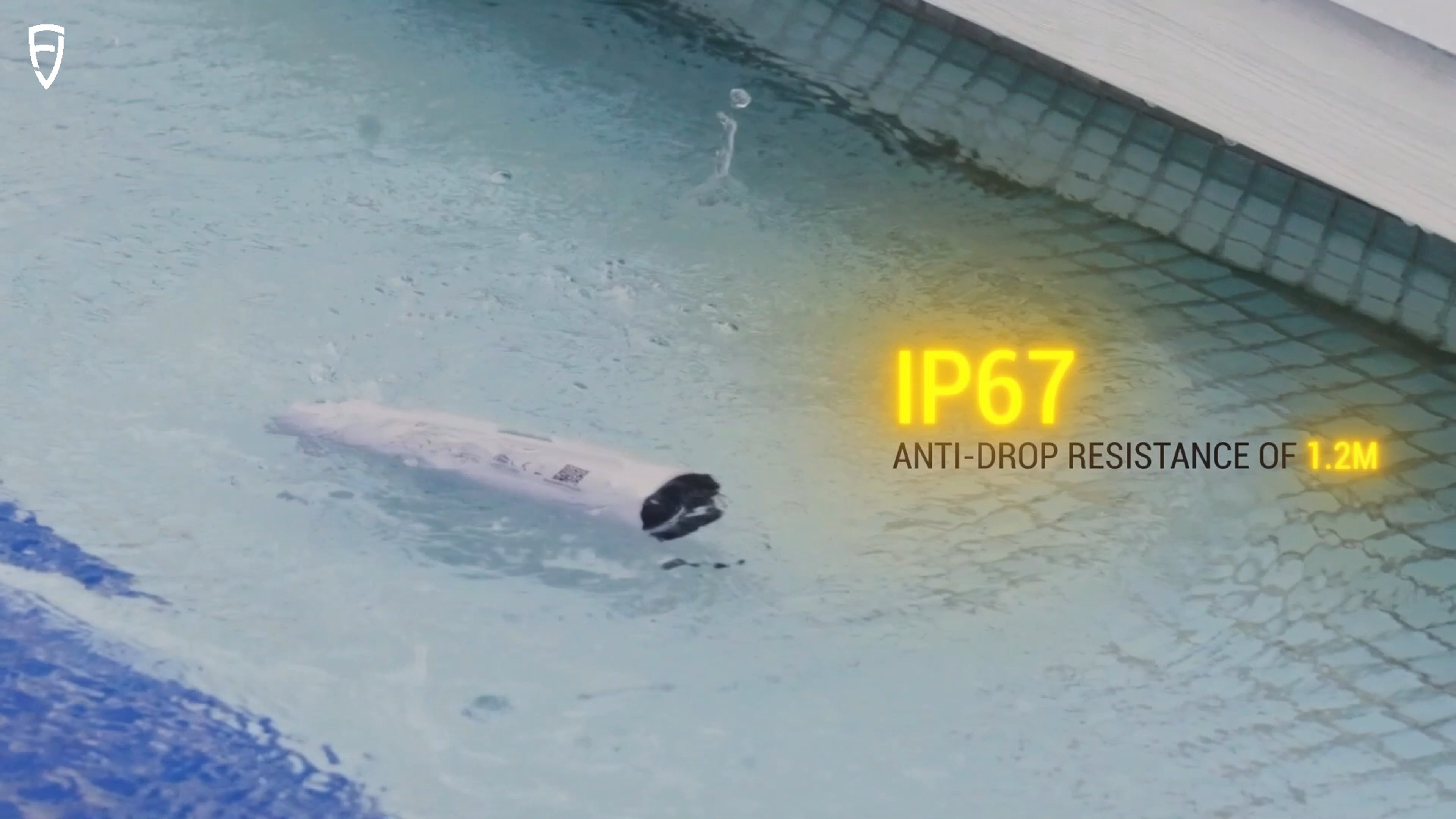
Protected. Durable. Reliable.
With IP67-rated protection against water and dust, and 1.2-meter drop resistance, the V4E is built to withstand tough environments. It keeps working reliably even when exposed to dust or accidental drops, ensuring consistent accuracy for your outdoor projects.

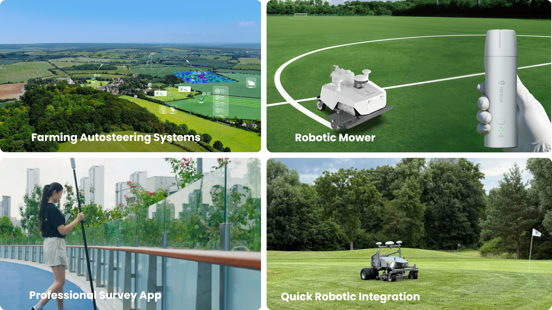
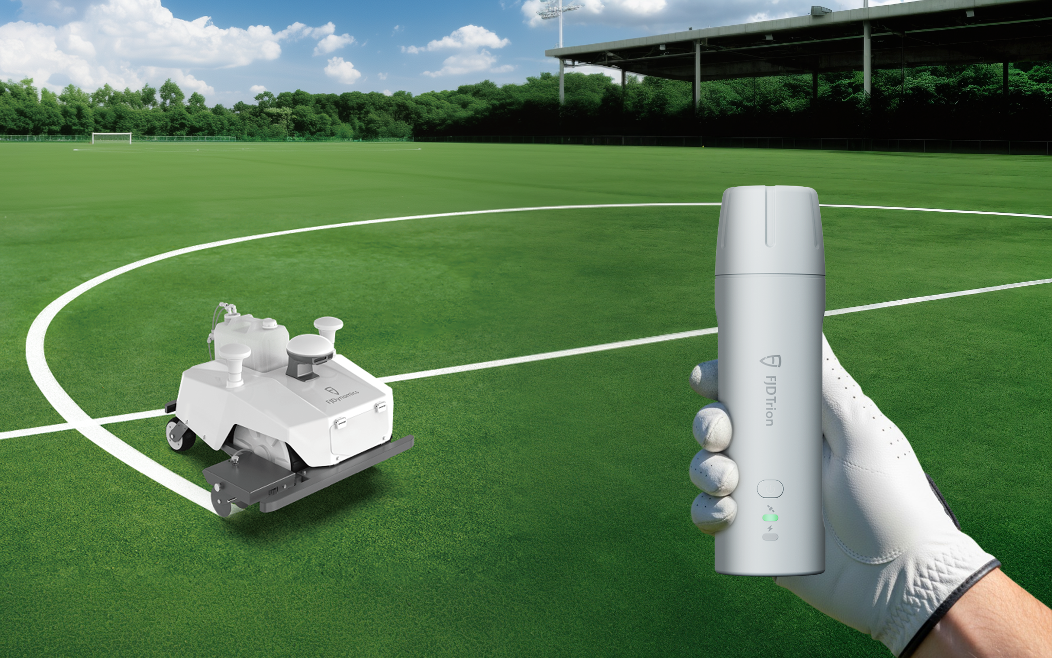
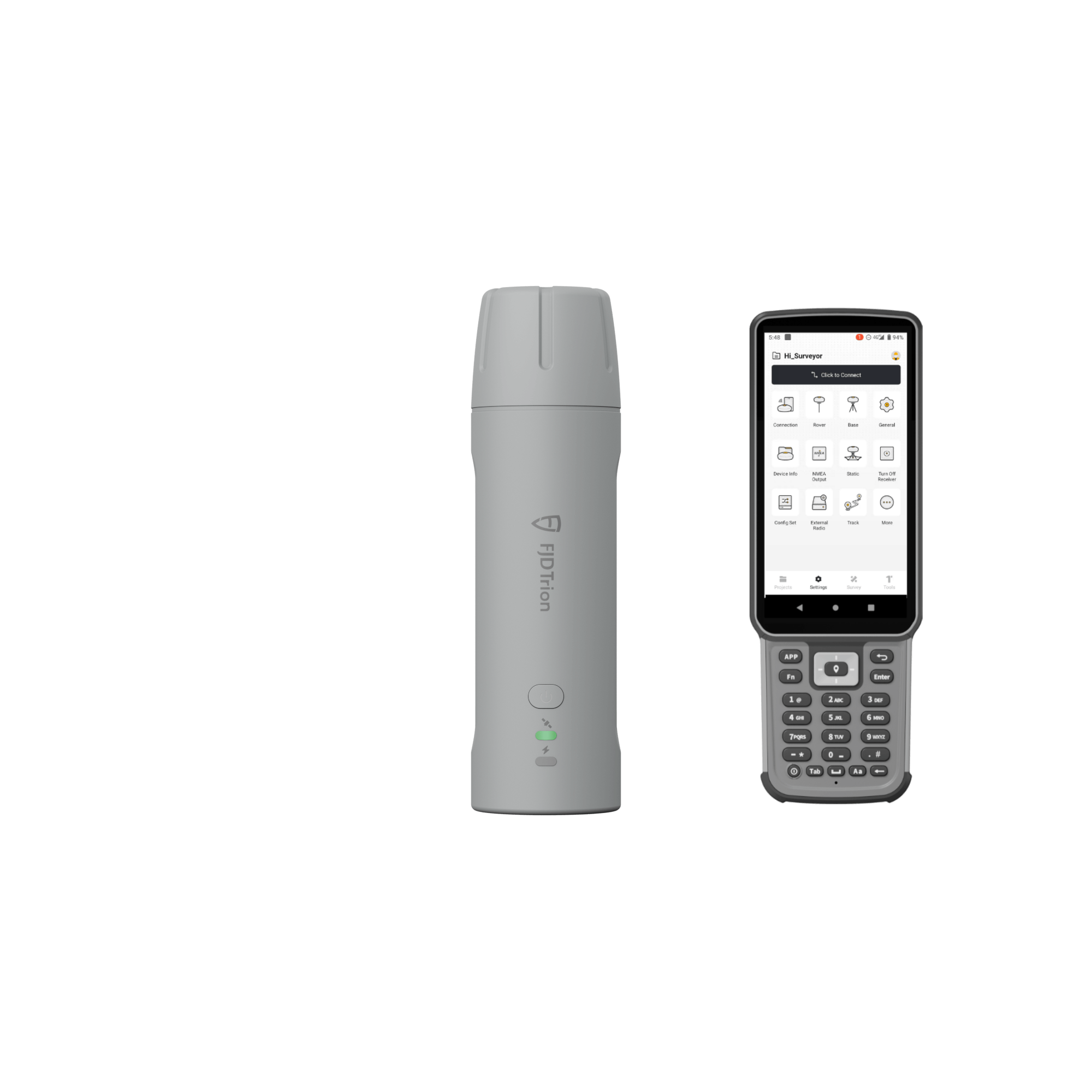
EASIER ACCESS TO FJD TECH ECOSYSTEM
Access the FJD ecosystem quickly for a smooth workflow from field to machine. The GNSS data you collect with the V4E in the field can be directly used by FJD's farming autosteering systems, robotic mowers, and other smart devices for automated tasks. You don't have to convert the data, allowing you to work faster and reduce mistakes.
* Beyond the FJD ecosystem, its open design also supports customization to fit your unique needs.
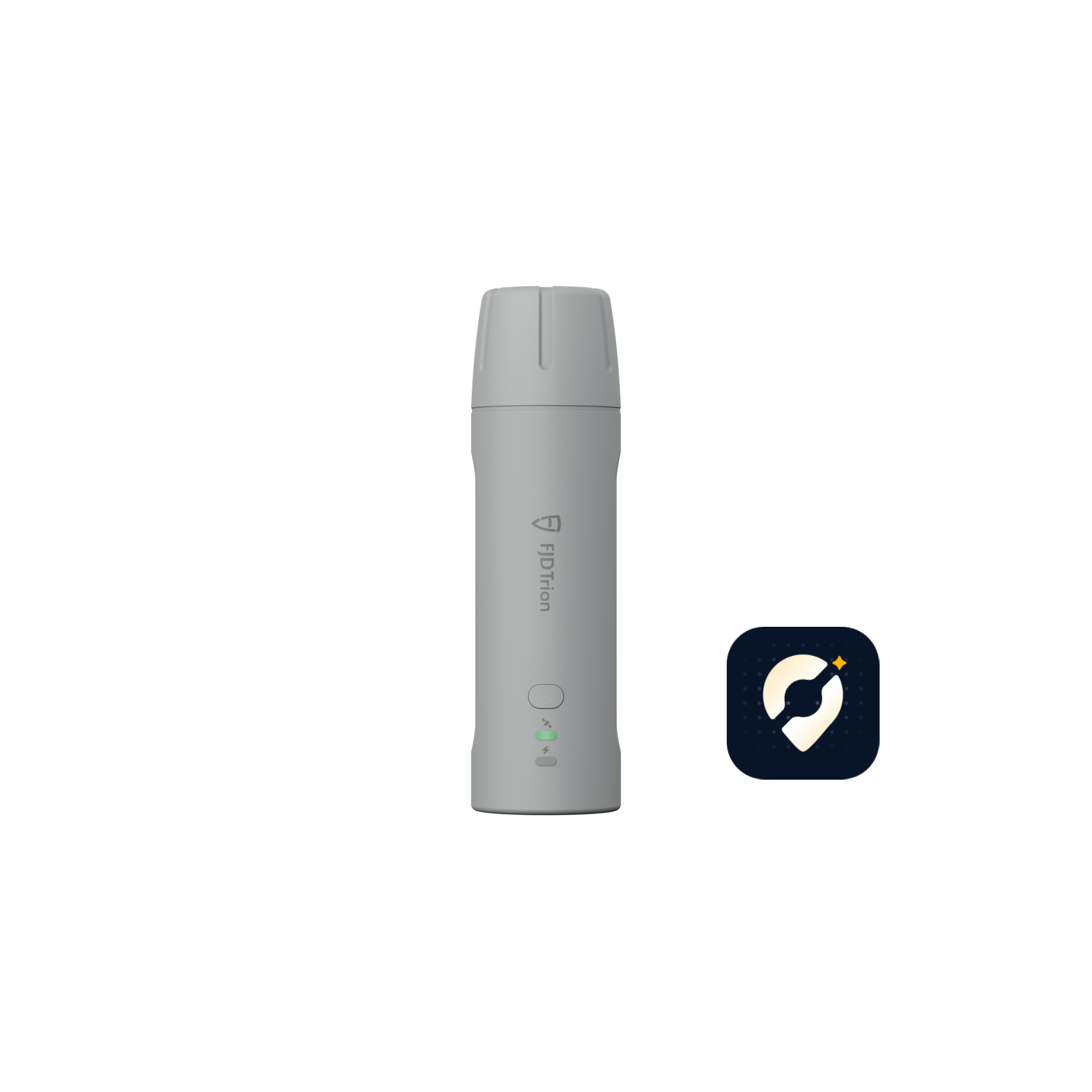
FJD Trion Survey App Introduction
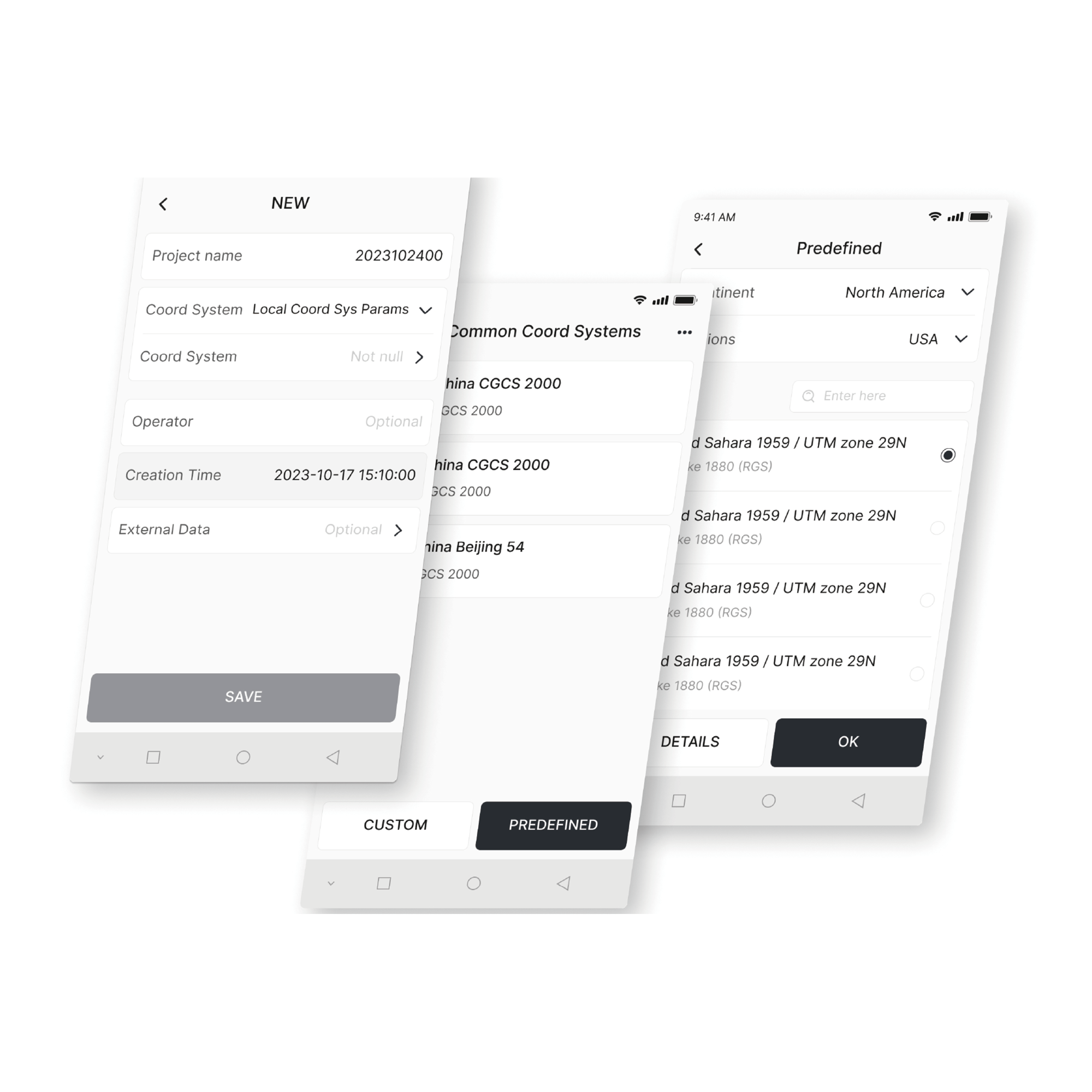
Coordinate Transformation
Create various plane and elevation models with over 8,000 coordinate systems, 70 ellipsoids, and 30 projections. You can also handle geoid corrections to meet your regional needs.
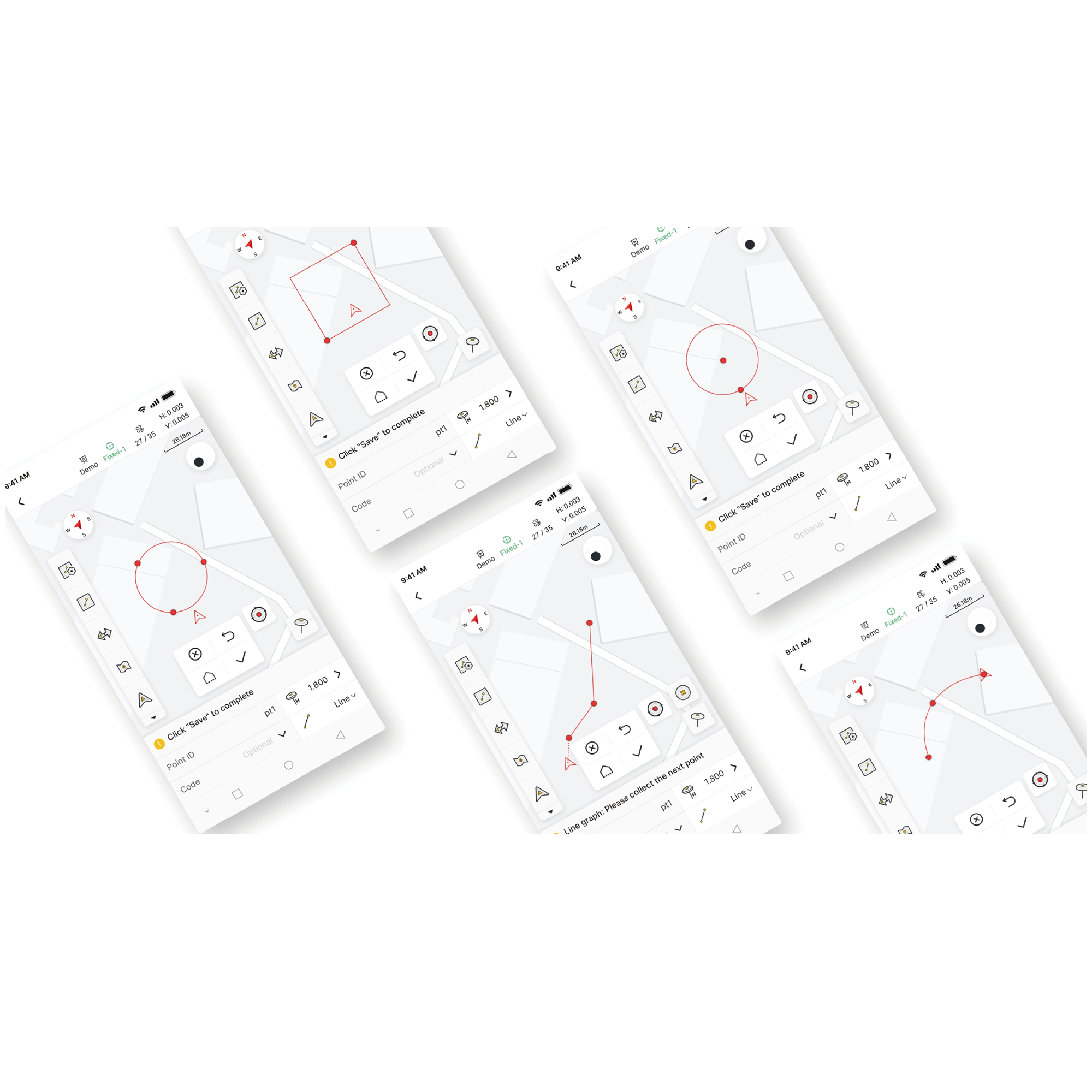
Measure & Draw
Get accurate positioning data and measure/draw 10 common shapes (including polylines, circles, and rectangles). You can also make code-based measurements with clear graphic categories to speed up post-survey mapping.
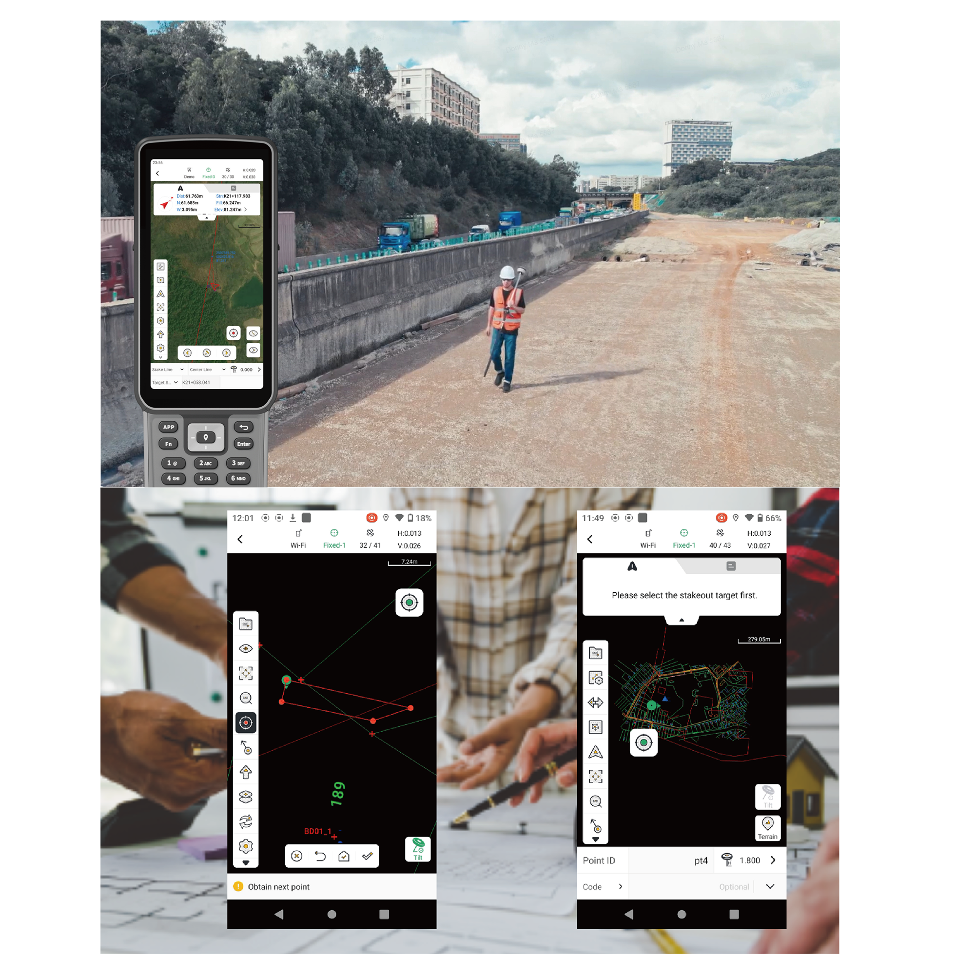
Efficient Staking & Smooth Coordination
After you process data in the Survey App, you can add custom labels and quickly export it into common CAD files for fast field staking. You can also use the app to view road details like station equations, alignments, cross-sections, and slopes. Once you've confirmed the staking information is correct, you can export it as a LandXML road file for fast sharing and smooth coordination.
Adaptable for Global Use
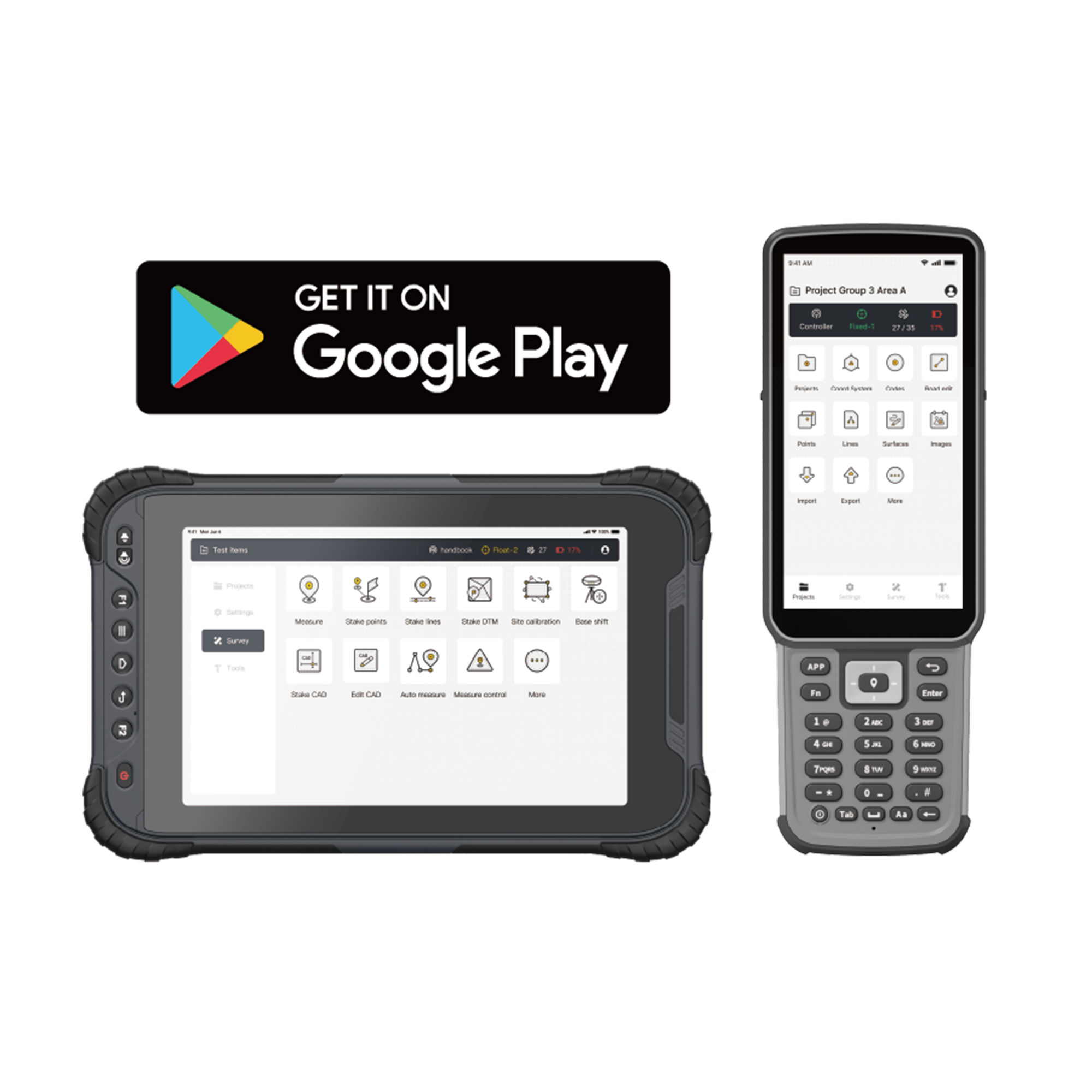
By supporting 16 languages, the Trion Survey App lets you process terrain data collected from V4E in your preferred language. Plus, you can freely switch between landscape and portrait modes for better data display and viewing on the 8-inch UA80 and 10-inch D10. This simplifies your workflow from field to processing, quickly getting your data ready for the next project.
Application Scenarios

Topographical Survey

Construction & BIM

Utilities & Public Works

Road Surveying
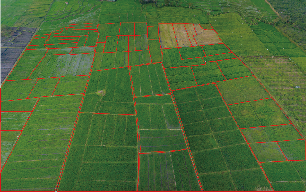
Forestry & Agriculture
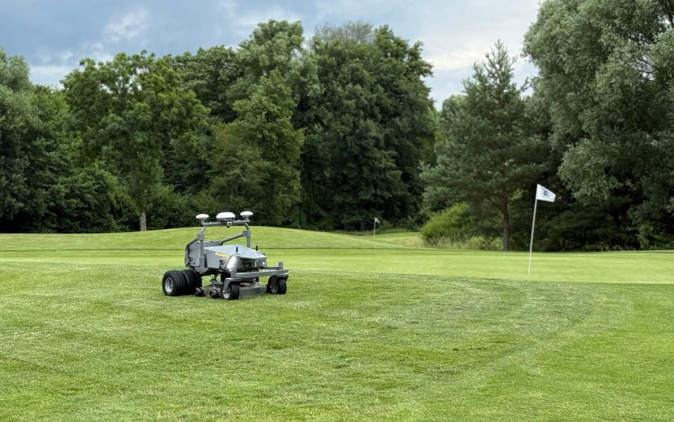
Quick Robotic Integration
Specifications
GNSS
1408 channels
L1C/A, L2P, L5
G1, G2
B1I, B2I, B3I, B1C, B2a, B2b*
L1, L2C, L5
L1C/A
Precision and Reliability
≤1s
Cold start≤30s; Hot start≤5s
<99.9%
- Measurement & Positioning:
- 1Hz, 2Hz, 5Hz, 10Hz, 15Hz, 20Hz
H≤1.5 m, V≤2.5 m
H≤0.4 m, V≤0.8 m
- H≤0.8 cm+1 ppm,
- V≤1.5 cm+1 ppm
20 ns
0.03 m/s
- 3D error at 3m distance measurement ≤3cm
- (tilt angle ≤30°) (V4E Pro)
Electrical and Interface Parameters
5V/2A
≤1.5W
USB 2.0 Type-C
≤3h
Physical Characteristics
PC+ABS
182x53x53 mm
1/4 thread internal interface
On/Off
Fixed disassembly & charging
IP67
-20℃ to 60℃
0℃ to 45℃
You may also like